All students who live within the home zone described below and/or shown on the attached map shall be entitled to enrol at the school.
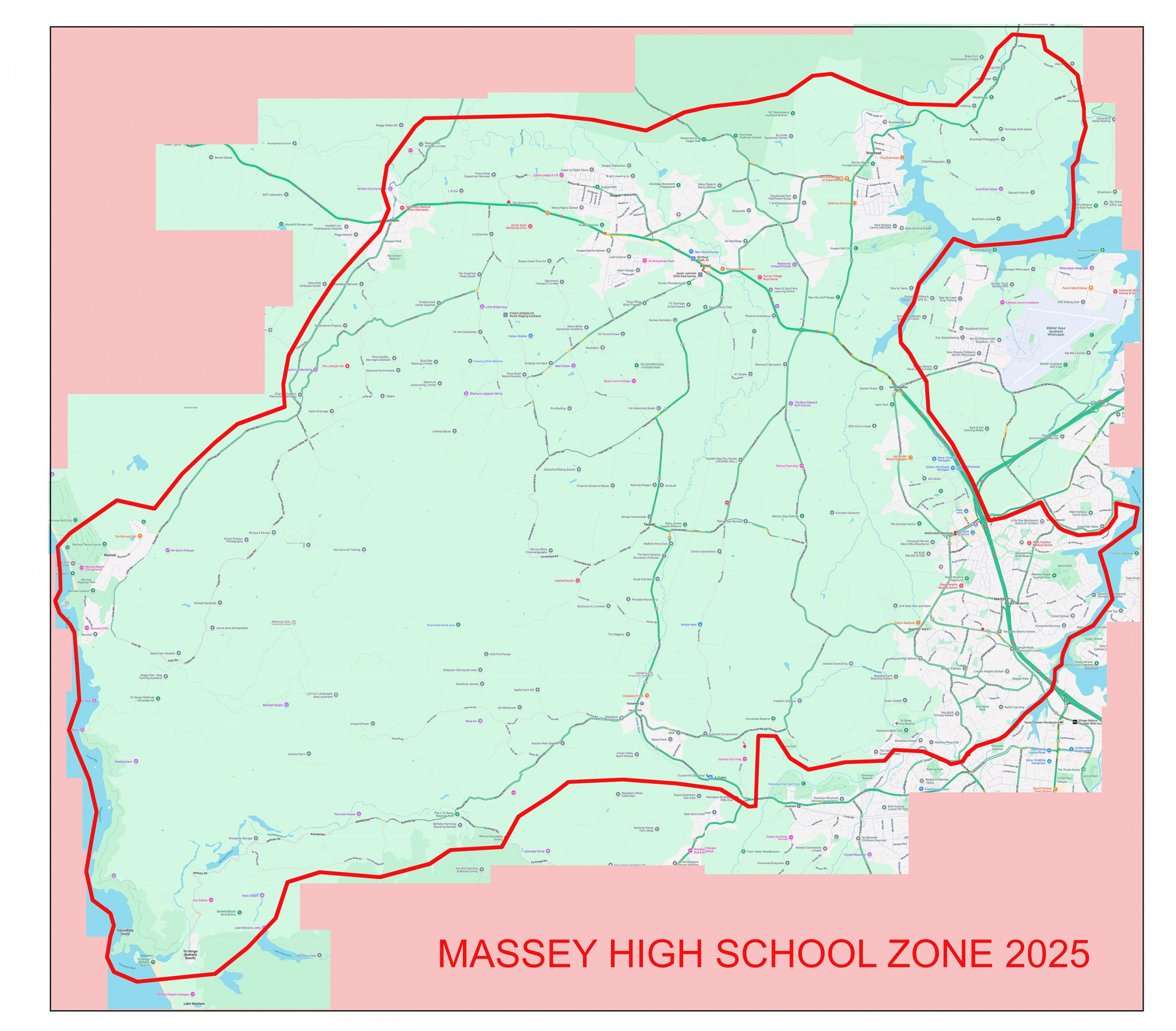
Starting at the west coast at Motutara Road, Muriwai, head along Muriwai Road to Waimauku, include State Highway 16 (999, 964 & below). Head east along State Highway 16 before turning north into Matua Road then Deacon Road. Include Old North Road to Pinetone Road (465, 338& below). Continue on Deacon Road to Riverhead Road then north on the Coatesville Riverhead Highway (odd 685, even 686 & above included) to Wake Road. Head southeast along the centre of Wake Road, Ridge Road and Brookdale Road to Paremoremo Creek. Follow the coast line south then west into Brigham Creek crossing Brigham Creek Road (21, 16 & below included) and on to the North Western Motorway. Head south on the Motorway to Hobsonville Road. Head east along the centre of Hobsonville Road (111 & below included) to Luckens Road (both sides included) to Renoir Street (included). From the end of Renoir Street, follow the coastline south into the Henderson Creek and into Woodside Road. Cross Don Buck Road (35, 28 & below included) into Glen Road then North West into Birdwood Road. Turn southwest into Crows Road, west into Sunnyvale Road south into Kay Road. Turn west into Waitakere Road. Turn into Bethells Road then Anzac Valley Road into Steed Road. Cut across country to the intersection of Unity Road and Te Henga Road (47, 42 and above included). Continue west on Te Henga Road and continue west on Bethells Road, to the coast. Head north along the coast to the starting point.
All residential addresses on included sides of boundary roads and all no exit roads off included sides of boundary roads are included in the zone unless otherwise stated.
Proof of residence within the home zone will be required.
To view a comprehensive zone map and check if your address falls in-zone or out-of-zone, please visit the Education Counts website.